
The live satellite map
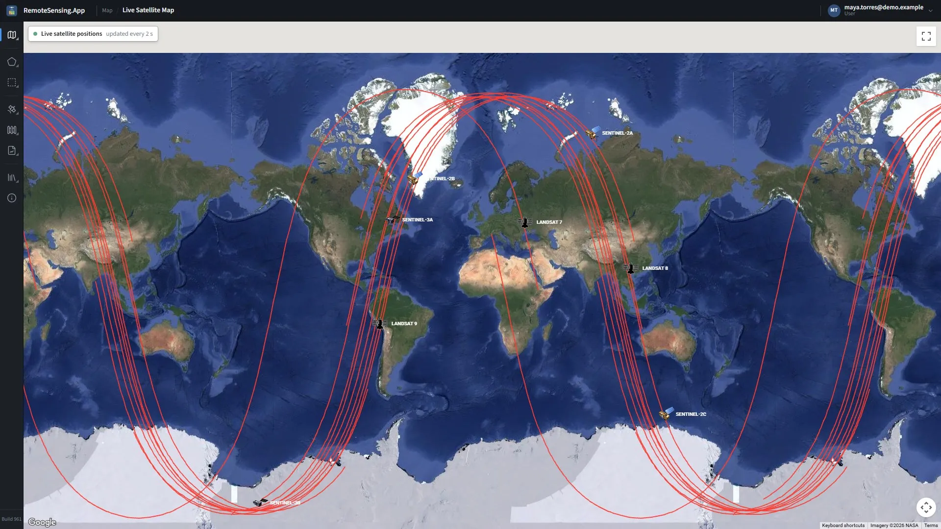
Map, Live satellite map: where the imaging satellites are now, and the ground they are about to cross.
The live satellite map shows where the satellites the site uses, and a few of their companions, are right now. It answers the question when will the next picture of my fields be taken? Open it from the rail: Map, Live satellite map.
What it shows
Section titled “What it shows”| Satellite | Notes |
|---|---|
| Sentinel-2A, Sentinel-2B | two of the satellites behind the site’s 10 m imagery |
| Sentinel-2C | the third; launched in 2024 to take over from Sentinel-2A, it takes many of the groups’ Sentinel-2 scenes |
| Landsat 8, Landsat 9 | the site’s 30 m imagery |
| Landsat 7 | retired from imaging; shown for reference |
| Sentinel-3A, Sentinel-3B | ocean and land colour at 300 m; not used by the site |
-
Each satellite has its own icon and its name beside it; hover over it for its full name. The icons move every 2 seconds.
-
The red line under a satellite is its ground track: the path it traces over the Earth through one orbit, starting 10 minutes ago. It is redrawn every 30 seconds.
-
The chip at the top left says whether the positions are live. When the orbits of some satellites could not be fetched, it names them; when none could, the dot stops pulsing and the chip says the orbit data is unavailable. Try again later: the site fetches the orbits from public sources, and caches them for six hours.
Move and zoom the map as you would any other.
Reading it
Section titled “Reading it”-
The satellites cross the equator going south in the morning, around 10:00 to 10:30 local time, on the sunlit side of the Earth. A track that will cross your group in the next hour or so means a picture is about to be taken, if the satellite is imaging there.
-
A pass is no promise of a clear picture: cloud is the most common reason a scene is not useful. The scene appears in the catalog once the satellite’s operators have published it, usually within a day (The satellite catalog).
-
Each Sentinel-2 or Landsat satellite comes back over the same ground on a fixed cycle; with the satellites now in service, a group sees a Sentinel-2 pass every five days or less and a Landsat pass about every eight days, more often where neighbouring tracks overlap.